
Role
Designer & Developer (AI‑assisted)
An Android app that answers one question a geology student asks constantly in the field: what am I standing on? It identifies the geological unit from GPS alone, works with no signal, and turns observations into structured field notes.
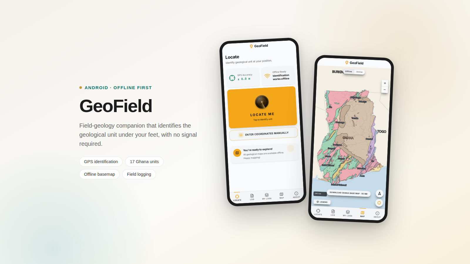
Field geology in Ghana runs into a practical wall. The geological map of the country exists, but in the field it lives on a paper sheet, a lecturer's memory, or a PDF on a laptop back at the hostel. Standing on an outcrop three hours from Kumasi, a student often cannot answer the most basic question: which unit is this?
Mobile data makes it worse. Coverage in the field is unreliable and expensive, so any tool that needs a connection to answer that question is the wrong tool. The constraint was clear from the start: it has to work with the phone in airplane mode.
Identification had to be fully offline. Not "offline-tolerant", not cached after first use, but correct on a phone that has never had signal at that location.
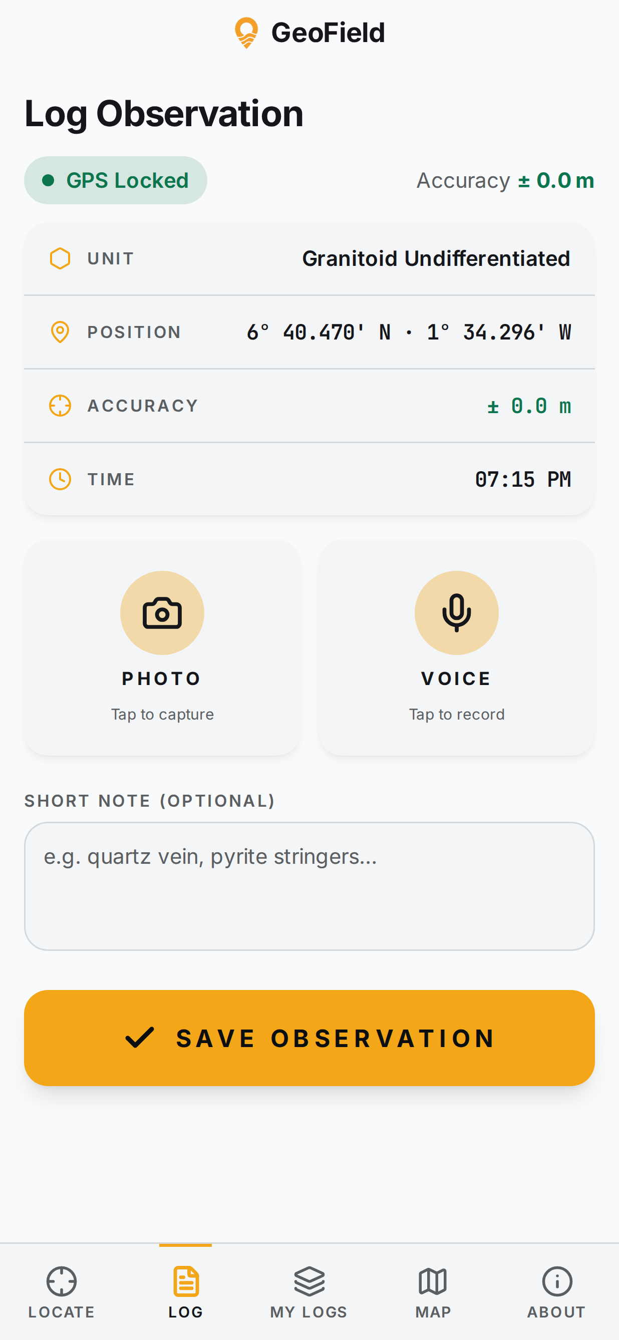
GeoField is built around three jobs, each mapped to a screen a student can reach in one tap.
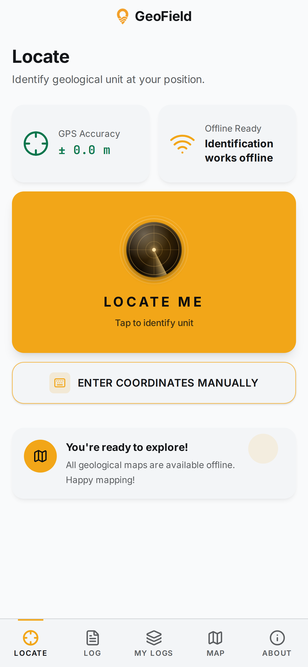
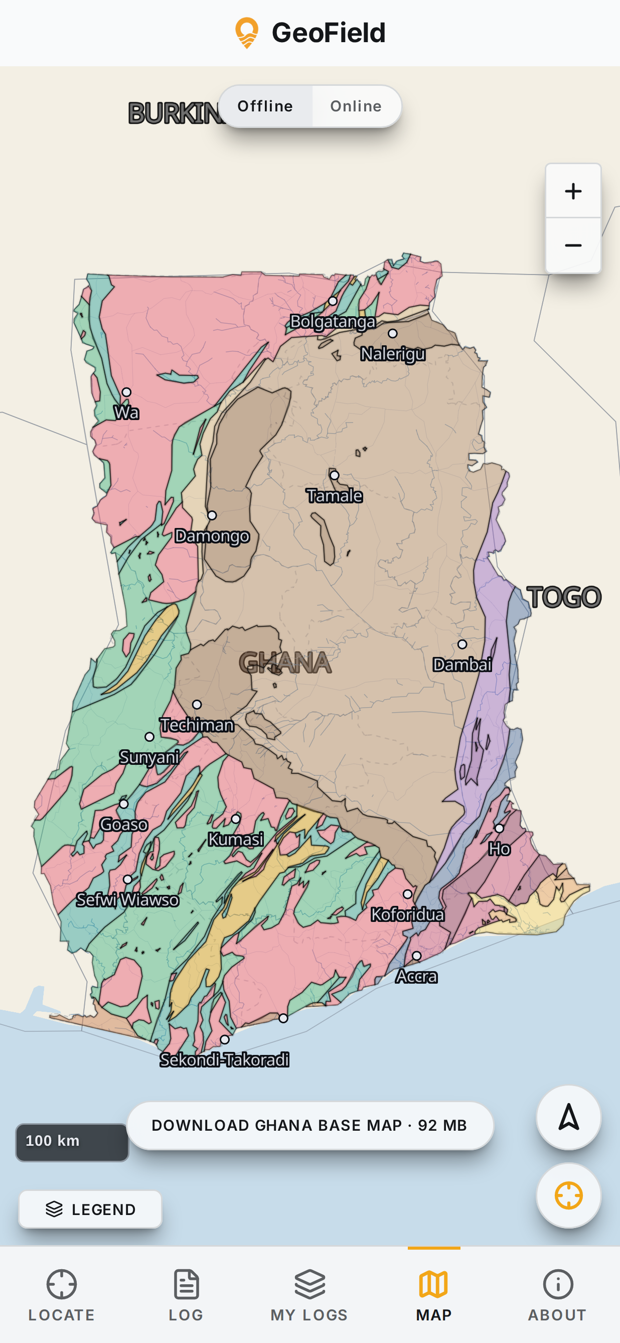
The identification engine carries the geological map of Ghana as GeoJSON bundled into the app: all 17 mapped units, from the Birimian volcanics and sediments that host most of the country's gold, through the Tarkwaian, Togo Series and Dahomeyan gneisses, to the Voltaian sequence and the recent coastal cover.
A GPS fix becomes a point-in-polygon test run entirely on the phone. No request, no tiles to fetch, no waiting. Each unit carries its own field content: what it is also called, the rocks and structures to expect, plus engineering and mineral notes, so the answer is not just a name but something a student can actually use at the outcrop.
Because GPS is the input, accuracy is treated as a first-class piece of information rather than hidden. The app surfaces the current fix accuracy, and every saved observation records it, so a log entry can be judged later on how well the position was known when it was taken.
A geological map with nothing underneath it is hard to navigate. But a country-wide basemap is large, and downloading it repeatedly over field data is not viable.
The solution was a 92 MB PMTiles basemap of Ghana, hosted separately and downloaded once, deliberately, on the student's terms. It is fetched in ranged chunks so a dropped connection resumes instead of restarting, and it is written to durable device storage so clearing the app cache does not destroy it. After that one download, the map is permanently available offline.
An earlier "high precision" mode averaged GPS readings while standing still. Field testing showed it performed worse than simply letting the fix converge, because consecutive GPS errors are correlated rather than random. The feature was removed. Averaging correlated noise does not cancel it.
Field conditions shaped the interface more than any style preference. Sunlight, one free hand, gloves, and a phone that must not waste battery all push in the same direction: large targets, high contrast, and short paths.
The app is React and TypeScript wrapped with Capacitor, so it ships as a native Android package while staying a single web codebase. The map renders with MapLibre GL. Field data is stored in durable native storage rather than the browser cache, because losing a day of observations is not an acceptable failure.
To be clear about how it was built: the code was written with AI coding tools rather than by hand. I am a geology student, not a developer by training. That changed how quickly the app existed, not what it had to do. The offline constraint, the geology behind the identification, and the way the screens work with one hand in the sun were the decisions, and those were mine.
Distribution is a signed APK published through GitHub Releases rather than the Play Store, which suits a tool aimed at a specific department: updates ship immediately, and students install directly.
GeoField is in active development and already usable in the field. The direction now is durability rather than features: cloud backup and restore, so a lost or reset phone does not take a semester of field notes with it.
The project sits exactly where my two interests meet. The geology decides what is correct, and the software decides whether anyone will actually use it in the field.
Interested in the app, or in geospatial tooling generally?
Get in touch